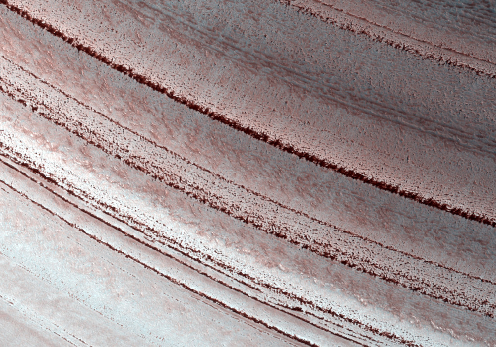
Sometimes icy layers can be ablated away during warm climates. Later the ice sheet can be buried by new ice layers and grow in size again; it’s likely that many of these cycles have occurred over the ice sheet’s history.
The Martian North polar layered deposits are an ice sheet much like the Greenland ice sheet on the Earth. Just as with the ice sheet in Greenland, this Martian ice sheet contains many layers that record variations in the Martian climate.
These sorts of fluctuations in the thickness of the ice sheet are most pronounced at the edges of the sheet where this HiRISE image was taken. The ice sheet ends here in a gentle scarp that slopes about eight degrees downhill from bottom to top in this image. The layering within the ice is exposed on this sloping surface; the thickness of the ice here is about 1 kilometer (about 3300 feet). Scientists are analyzing these layers to see what information they might hold regarding previous Martian climates.
Most of the layers are parallel to each other. However, if you look more closely at the layers near the base of the slope then you can see that they are orientated at odd angles to each other. This happens when the ice sheet undergoes the fluctuations in thickness described above. Ice is ablated away and the new ice sheet surface cuts at an angle through several layers. When ice starts being laid down here again, it is in layers parallel to the surface and so at an angle to the older layers. Much later this sloping surface was created by erosion and gives us a cross-sectional view of all the layers and the angles they make with each other. When sloping layers are truncated by flat ones like this geologists call it an angular unconformity.
This location is especially interesting because the ice sheet partly covers an impact crater that is about 17 kilometers (about 10 miles) diameter. You can see the rim of this crater on the flat terrain in the top quarter of the image. The curving crater rim is partly buried by the ice sheet here. The slopes within the crater caused the lowest elevation ice layers to be tilted and probably led to the abundance of angular unconformities at this location.
Written by: Shane Byrne (31 March 2010)
More info and image formats at http://hirise.lpl.arizona.edu/ESP_016973_2595
Image: NASA/JPL/University of Arizona
