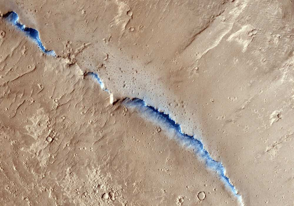
This image completes a mosaic of images covering a collection of streamlined islands in Athabasca Valles. Streamlined islands form by a rapid erosive flow (catastrophic flooding) around an obstacle such as a resistant rock outcrop or surface armored by impact ejecta.
Examination of the margins of the islands can show evidence of terraces as in this image. Each terrace may indicate a different flow event or flood level, and can be used to reconstruct the history of flood events.
Written by: Mike Mellon (audio by Tre Gibbs) (14 November 2012)
More info and image formats at http://hirise.lpl.arizona.edu/ESP_028519_1895
Image: NASA/JPL/University of Arizona