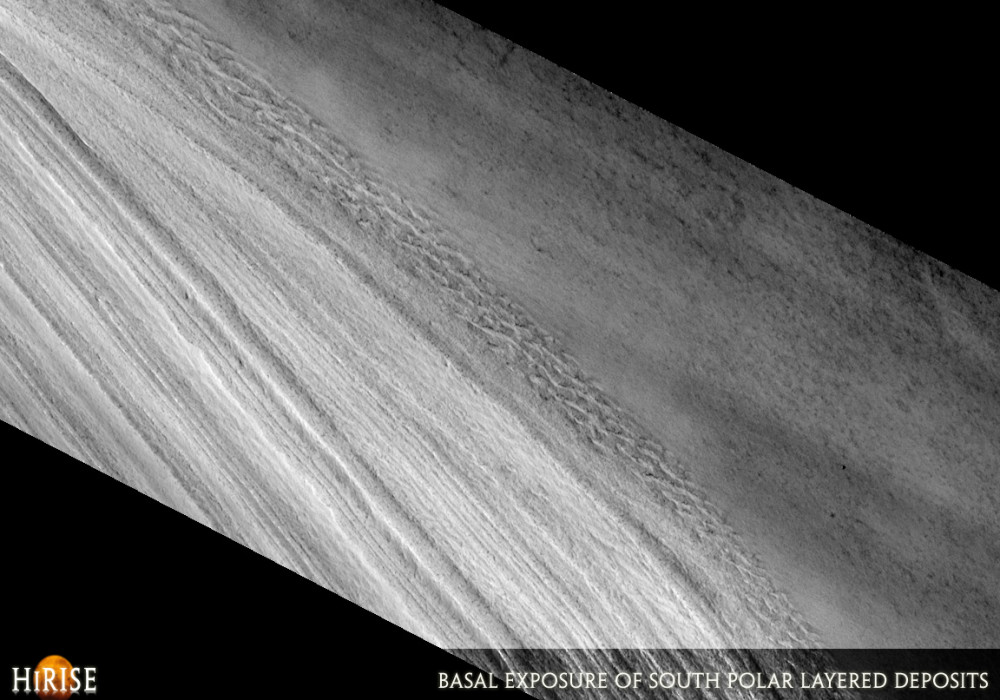
This full HiRISE image shows layers exposed on the scarp that bounds the south polar layered deposits. These deposits make up a geologic unit of layered water ice, containing a small amount of dust. The different ice layers are thought to record varying climatic conditions in the history of Mars, in much the same way that layers within ice-sheets on the Earth can tell us about how our own climate has changed.
The top of this scarp is near the top/left of the image and is about 800 meters (half a mile) above the bottom, although only the lower 560 meters (1840 feet) is shown here. Near the bottom of the scarp, the icy layers have a disrupted, irregular appearance. This irregular wavy appearance may have been caused by the flow of ice at some point, although it is currently too cold on Mars for significant flow to be occurring today.
Layers near the top of the image appear to be converging and some of the lower layers appear truncated. Geologists call this an unconformity, as it indicates that there was a previous episode of erosion that removed material down to the truncated layers. Subsequent deposition then built this stack of ice back up to its current thickness. Features like this, as well as the layers themselves, can help planetary scientists figure out what past climates on Mars may have been like.Written by: Shane Byrne (via Nathan Bridges) (2 August 2007)
This is a stereo pair with PSP_004720_1050 .
More info and image formats at http://hirise.lpl.arizona.edu/PSP_004311_1050
Image: NASA/JPL/University of Arizona