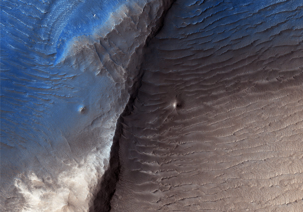
Geologists aren’t quite sure what to make of the dark splotch in the middle of this image, one of several similar dark splotches that extend east and west for over 100 kilometers. From measurements made in infrared, this and other dark splotches have what we call “high thermal inertia,” meaning that it heats up and cools down slowly. Scientists use thermal inertia to assess how rocky, sandy, or dusty a place is. A higher thermal inertia than the surrounding area means it’s less dusty.
Wavy, banded patterns in the dark splotch (possibly due to cross bedding from sand dunes that once occupied the area) were lithified into sandstone, and then eroded away. These clues could help geologists figure out what’s going on there.
Written by: Kirby Runyon (audio: Tre Gibbs) (9 October 2017)
This is a stereo pair with PSP_008935_1975 .
More info and image formats at http://hirise.lpl.arizona.edu/ESP_016372_1975
Image: NASA/JPL/University of Arizona