This observation shows great exposures of layered rocks in Argyre region. Could it be evidence for an ancient sea or lake?
The Argyre region, also known as the Agyre quadrangle by the USGS, is also home of the Argyre impact basin, which contains some ancient eroded terrains, as well as other impact craters that HiRISE has imaged: Green Crater , Galle Crater , and Charitum Montes .
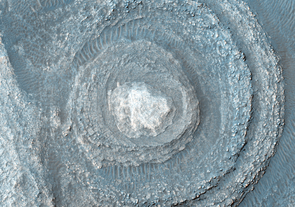
This subimage from the color swath (approximately 1.2 kilometers across) shows some of the rocks and layers in greater and impressive detail. (Note: the subimage is not map-projected so North is approximately down.)
This caption is based on the original science rationale.
Written by: HiRISE Science Team (4 May 2011)
This is a stereo pair with ESP_014167_1300 .
More info and image formats at http://hirise.lpl.arizona.edu/ESP_021947_1300
Image: NASA/JPL/University of Arizona