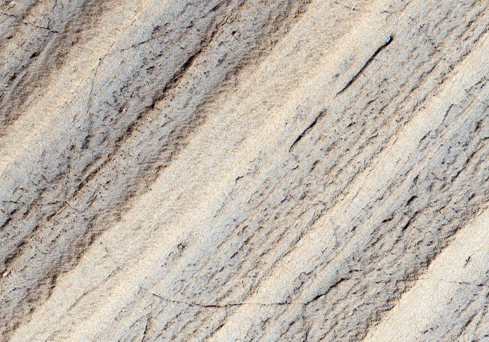
This image shows an exposure of south polar layered deposits, thought to record recent global climate changes on Mars.
The layers were probably laid down over the past few million years over a large area near the south pole, then eroded to show the layering visible in this image. The layers appear brighter where their slopes are steeper and facing the sun.
Within the brighter, steeper part of the layered deposits, a network of polygonal fractures is visible. The polygons outlined by the fractures are typically a few hundred meters (approximately 1000 feet) across, and traverse layer boundaries. Such polygonal fractures are seen on Earth in places where ground ice is present, and previous Mars orbiters have found evidence for abundant ground ice in the south polar region of Mars. So it is not surprising to see polygonal fractures here; what is unusual is that they cross layer boundaries, apparently unaffected by the changes in slope across them.
This suggests that the polygonal fractures formed after the scarp exposing the south polar layered deposits was formed by erosion. This indicates, possibly, that the scarp has been stable for some time, allowing the polygonal fractures to form.
Written by: Ken Herkenhoff (12 August 2007)
More info and image formats at http://hirise.lpl.arizona.edu/PSP_004324_1060
Image: NASA/JPL/University of Arizona