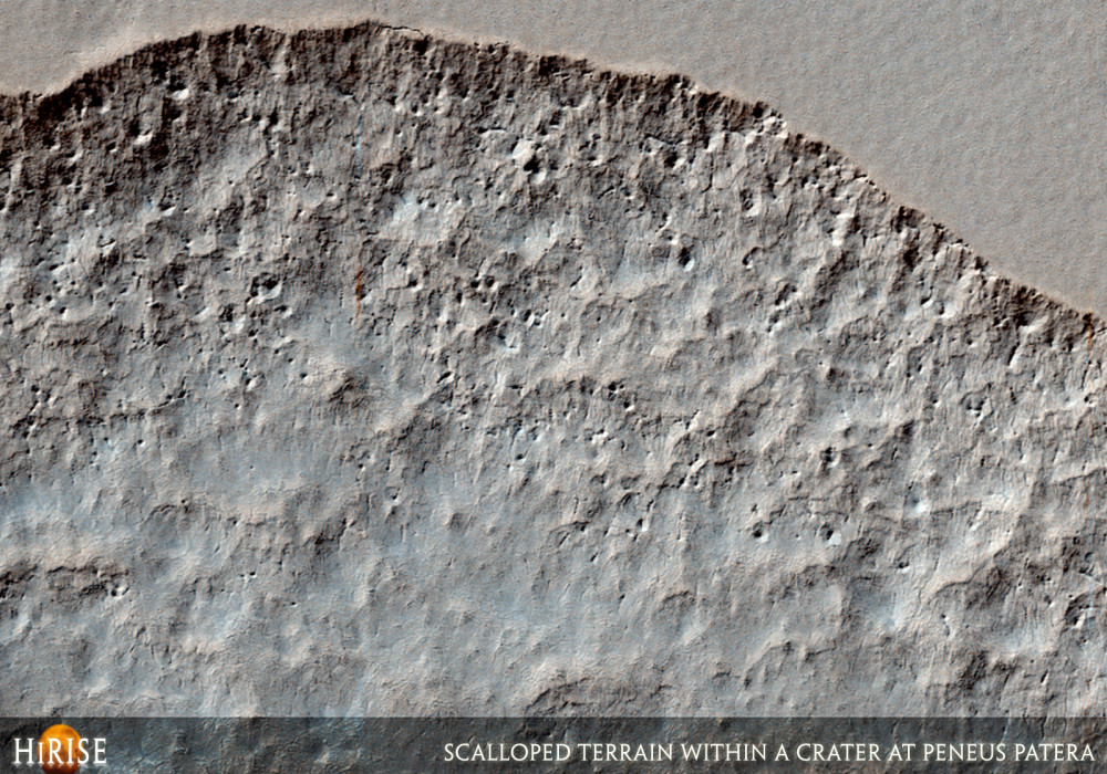
This image reveals depressions in the mid-latitude mantle within a crater at Peneus Patera.
The depressions, several of which have coalesced together, have scalloped edges. Such features form what is often referred to as “scalloped terrain.” Scalloped terrain is most commonly found at approximately 55 degrees north and south latitude and has led to hypotheses of the removal of subsurface material, possibly interstitial ice by sublimation (evaporation). The formation of scalloped terrain is believed to be an ongoing process today.
In this image, steeper scarps consistently face the south pole while more gentle slopes face in the direction of the equator. This is most likely due to differences in solar heating.
On the surface surrounding the scalloped depressions is a polygonal pattern of fractures. This is commonly associated with scalloped terrain, and indicates that the surface has undergone stress potentially caused by subsidence, desiccation, or thermal contraction. Also on the surface surrounding the depressions are dark toned dust devil tracks.Written by: Maria Banks (2 December 2007)
This is a stereo pair with PSP_005632_1225 .
More info and image formats at http://hirise.lpl.arizona.edu/PSP_005342_1225
Image: NASA/JPL/University of Arizona