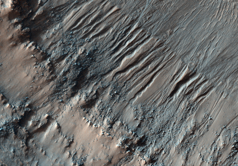
This image shows a crater in Terra Cimmeria, approximately 10 kilometers (6 miles) in diameter. The roughly concentric ridges and troughs in this crater’s floor are known as “concentric crater fill,” and probably result from compression caused by viscous flow of a thick mixture of rocks, soils, and ice inward from the crater’s walls.
This and other examples of concentric crater fill occur at high latitudes, where theoretical calculations indicate that ice may exist under the surface, mixed with rocks and soil.
This subimage shows a small portion of the crater’s north-looking wall (downhill is up, illumination is from the left). In the lower part of the subimage a relatively harder, rocky layer protrudes from the crater’s wall; some blocks broke up from it and fell down the slope. Loose soils accumulated behind these blocks (uphill), forming what looks like bright-colored tails. The crater’s floor, in the upper part of the subimage, is covered here by elongated dunes. A channel 7 to 20 meters (7.5 to 22 yards) wide cuts deeply into the crater’s wall; it is unclear if this channel was carved by a fluid or by landslides.
The channel is cut by a younger scarp (shown with yellow arrows pointing downhill) which approximately separates the crater’s wall from its floor. This cliff can be followed for more than 3 kilometers (2 miles) along the Southern part of the crater’s floor. Elsewhere in this image channels similar to the one shown here cut through (and, therefore, are younger than) the scarp, extending inside the crater’s floor. This scarp may have been produced by settling of the crater’s floor, maybe due to flow of ice, soil, and rocks towards the center of the crater, and/or to sublimation of underground ice.
Written by: Sara Martinez-Alonso (8 September 2010)
More info and image formats at http://hirise.lpl.arizona.edu/PSP_001936_1370
Image: NASA/JPL/University of Arizona
